Fox Glacier Valley Monitoring
GeoNet currently operates five sites in the Fox Glacier valley, including the Alpine Gardens landslide, that collect environmental and GNSS data. Envirosensors measure various parameters at active and potential landslides with a view to understanding what influences the rate of landslide movement and slope deformation. The work is done in collaboration with the Climate-Induced Landslides project within GNS' Hazards and Risk Management Strategic Science Investment Fund programme.
Four of the sites are located on the valley sides of Fox Glacier, which has retreated more than 800 m since 2009. The retreat of the glacier reduces support along the valley walls allowing the rock slopes that form the valley walls to relax and can result in more landslides and rockfalls. To monitor this process, we place instruments (crack-meters) over cracks in the rock on the valley walls to monitor how the cracks deform, open, and close through time. Alongside this we monitor environmental data like rainfall, humidity, and air temperature to understand how environmental changes affect crack movement.
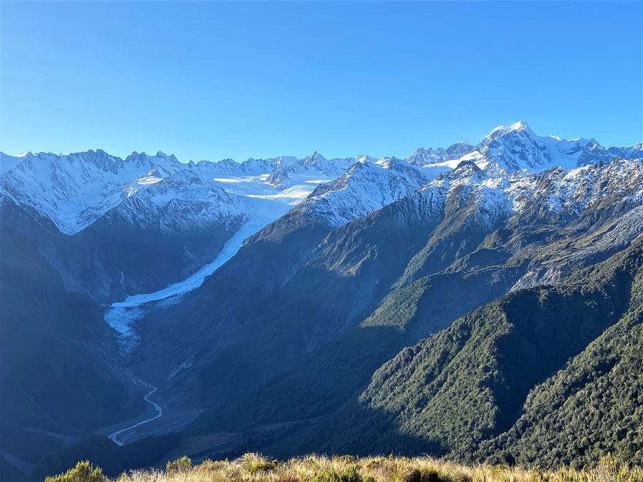
View of Fox Glacier from the west.
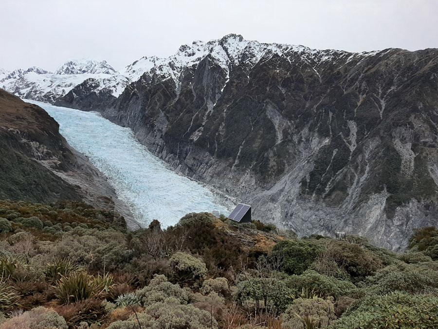
Close view of Fox Glacier with a GeoNet station in the foreground.
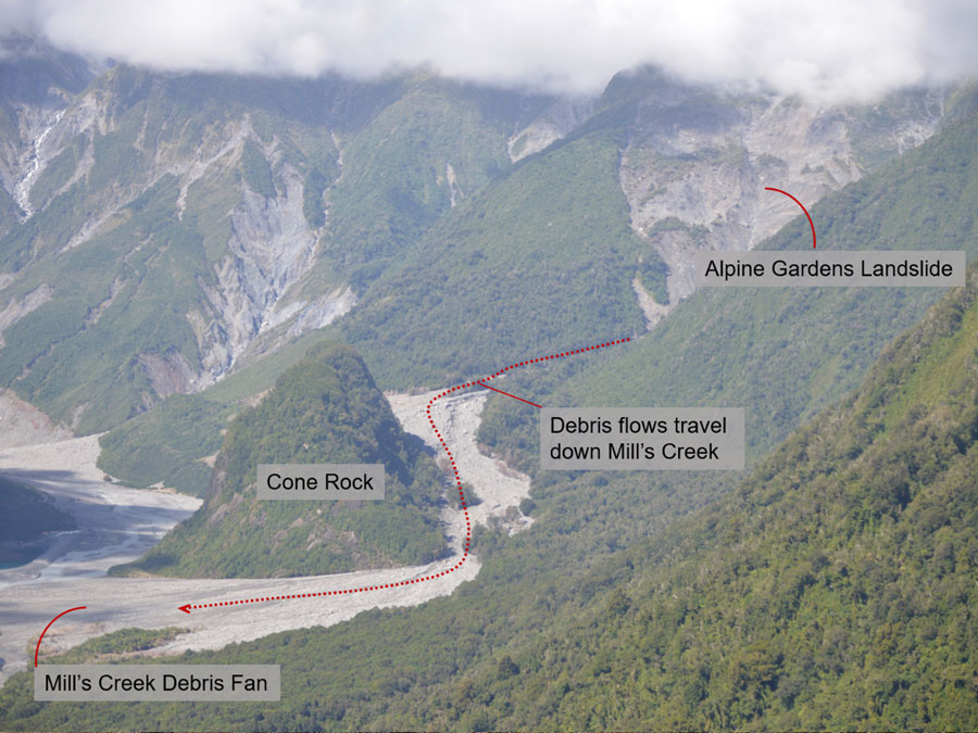
Alpine Gardens landslide and debris flow.

Alpine Gardens landslide with GeoNet station in foreground.
The fifth site is located on the Alpine Gardens landslide, which is currently one of New Zealand's largest actively moving landslides. The rate of movement of the landslide is monitored via a GNSS sensor on the landslide. Rainfall and soil moisture are also monitored to understand how changes in environmental conditions affect the rate of movement of the landslide. The rate of movement of the Alpine Gardens landslide fluctuates in response to rainfall events. On average, it moves 115 mm/day but on some days, it moves a lot faster, and on other days it doesn't move at all. After storms in March 2019 and December 2019, the landslide moved at approximately 500 mm/day for several days before slowing down.
Geodetic Data
The graphs below show GNSS Time Series data recorded since the FOX1 station was deployed. They show the ground surface displacement in 3 directions: East-West, North-South and up-down. By combining these 3 components of the displacement we can obtain the total motion of the Alpine Gardens landslide.
Helpful Links
Explore & Download More Data - Tilde Data Exploration Tool
If you want to download data or explore more environmental or other data types, try our Data Exploration Tool.
About - Envirosensors
Learn about how we collect environmental data through our Envirosensor Network.
Geodetic Data - GNSS
For displacement data in the Fox Glacier area, you can use our Geodetic Map to plot time series graphs.